What This Journey Actually Gives You
Beyond the Route Map, Beyond the Summit Photo
When the trek ends and the road curves back toward Kathmandu, most travelers realize the experience was never only about crossing Larkya La Pass or standing beneath Mount Manaslu.
It was about moving through a complete Himalayan civilization corridor, where geography still determines language, belief, architecture, diet, trade patterns, and even musical traditions.
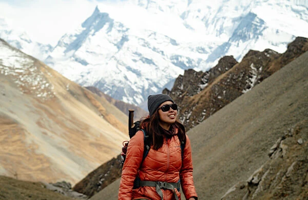
For nearly two weeks, your world narrows to one river valley, a chain of settlements, and the steady presence of mountains rising above 7,000 and 8,000 meters. You are not traveling between viewpoints. You are walking through inhabited terrain where families farm, herd animals, raise children, and conduct rituals at altitudes that would be considered extreme anywhere else on Earth.
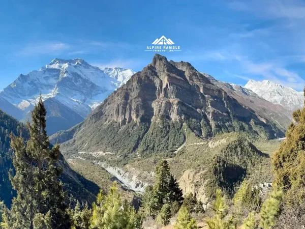
The Manaslu Circuit does not deliver a single spectacle. It delivers continuity. Subtropical river valleys transition into temperate forests, then into alpine tundra, then into glacial desert. Hindu mid-hills gradually give way to Tibetan Buddhist highlands. Agriculture yields to yak pastoralism. Warm air thins into sharp, dry wind carrying snow crystals across the pass.
This is not staged wilderness. It is a functioning mountain world.
Geographic Core of the Manaslu Circuit
| Feature |
Details |
| Region |
Manaslu Conservation Area, Gorkha District, Nepal |
| Protected Since |
1998 (Manaslu Conservation Area established) |
| Highest Mountain |
Mount Manaslu — 8,163 m (World’s 8th highest peak) |
| Highest Trek Point |
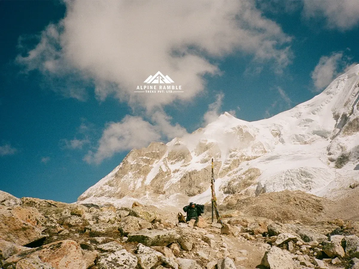
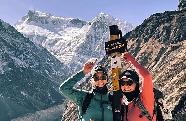
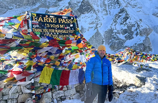
Larkya La Pass — 5,106 m |
| Primary River |
Budhi Gandaki River |
| Start Area |
Machha Khola (~900 m elevation) |
| End Area |
Dharapani, Lamjung District (Annapurna region connection) |
| Border Proximity |
Close to Tibet Autonomous Region, China |
Mount Manaslu was first successfully climbed on 9 May 1956 by Japanese mountaineer Toshio Imanishi and Sherpa Gyalzen Norbu, beginning a long Japanese connection to the mountain. Despite this early ascent, Nepal restricted access to the surrounding region until 1991, preserving both ecological integrity and cultural isolation for decades.
The conservation area today spans approximately 1,663 square kilometers, encompassing six climatic zones and dozens of villages connected by ancient trade routes between Nepal and Tibet.
The River That Shapes Everything: Budhi Gandaki
For most of the early trek, your path traces the Budhi Gandaki River, a glacier-fed artery descending from Manaslu’s northern ice fields.
In Sanatan tradition, the Gandaki system is sacred, associated with purification and pilgrimage. In geological terms, this river carved one of the deepest gorges in Nepal, forcing trails onto narrow ledges, terraced slopes, and dramatic suspension bridges.
You rarely stop hearing it.
Sometimes it murmurs far below like distant thunder. At other times it surges beside you, opaque gray with pulverized rock ground by moving ice above.
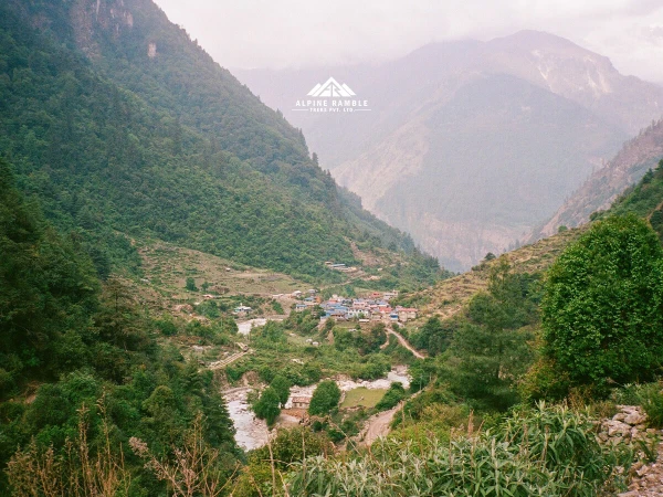
Villages appear where the terrain allows them to exist, not where planners placed them. Terraces cling to slopes. Bridges connect communities that would otherwise be completely isolated during monsoon or winter snow.
People, Culture, and Civilizational Transition
The Manaslu Circuit is as much an anthropological journey as a physical one. Within a span of roughly 150 kilometers, you move across cultural zones shaped by migration, trade, religion, and environment over centuries.
Lower Valleys — Hindu Mid-Hill Culture
Communities: Gurung, Magar, Brahmin, Chhetri
Religion: Sanatan traditions with local animistic elements
Economy: Terrace farming, livestock, remittances, military service
Rice, millet, maize, and seasonal vegetables dominate agriculture. Village shrines dedicated to local protective deities stand along trails. Prayer offerings may include flowers, rice, vermilion powder, or animal sacrifice during festivals.
Dal bhat remains the staple meal, eaten twice daily. Music often features traditional drums and bamboo instruments during celebrations.
Many Gurung households maintain historic ties to the British and Indian Gurkha regiments, embedding global military history into otherwise remote villages.
Upper Valleys — Tibetan Buddhist Highlands
Communities: Nubri and related Tibetan-origin groups
Religion: Nyingma school of Tibetan Buddhism
Settlement Pattern: Compact stone villages adapted for snow and wind
From Namrung onward, architecture shifts noticeably. Houses become stone-built with flat roofs for drying grain and storing fuel. Mani walls carved with sacred mantras line the trail. Prayer flags mark passes, bridges, and ridges.
Villages such as Lho, Samagaon, and Samdo were historically part of trans-Himalayan trade networks exchanging salt, wool, grain, and livestock between Tibet and Nepal.
Monasteries such as Pungyen Gompa remain active spiritual centers. Rituals follow lunar calendars, and masked dances during festivals preserve traditions dating back centuries.
Archaeological and Historical Significance
Although not widely publicized, the Manaslu region contains remnants of ancient trade routes predating modern nation-state boundaries. Oral histories suggest regular caravans moving salt and wool southward while grain moved north.
Stone chortens, mani walls, and abandoned seasonal settlements visible along the trail provide tangible evidence of these exchanges. Scholars consider the Nubri Valley one of the least altered Tibetan cultural zones outside Tibet itself.
The region also lies within historic Gorkha territory, birthplace of King Prithvi Narayan Shah, who unified modern Nepal in the 18th century. Many guides and porters working on this route trace ancestry to these hill communities.
Wildlife and Ecology: A Vertical Planet in Miniature
Few trekking routes compress so many ecological zones into such a short horizontal distance.
Vegetation Zones
- Below 1,500 m: subtropical forests of sal, bamboo, and broadleaf trees
- 1,500–3,000 m: temperate forests of pine, oak, and rhododendron
- 3,000–4,000 m: subalpine juniper and scrub
- Above 4,000 m: alpine meadows, tundra, and glacial terrain
Spring months bring widespread rhododendron blooms, Nepal’s national flower.
Wildlife You May Encounter
- Himalayan tahr navigating steep slopes
- Blue sheep (bharal) grazing near high pastures
- Musk deer in forested zones
- Langur monkeys in lower valleys
- Himalayan monal pheasant flashing iridescent colors
- Lammergeier vultures circling thermals
Snow leopards inhabit remote sections of the conservation area but remain rarely seen.
Climate Across the Year
| Season |
Conditions |
Advantages |
| Spring (Mar–May) |
Mild temperatures, flowering forests |
Clear views, stable conditions |
| Summer (Jun–Aug) |
Monsoon rain below ~3,000 m |
Lush landscapes, very few trekkers |
| Autumn (Sep–Nov) |
Crisp air, excellent visibility |
Peak trekking season |
| Winter (Dec–Feb) |
Cold, snow near and above the pass |
Extreme solitude, challenging travel |
Temperature variation can exceed 40°C across elevations, from warm subtropical conditions to sub-zero alpine nights.
Major Peaks Visible on the Trek
- Mount Manaslu — 8,163 m
- Himalchuli — 7,893 m
- Ngadi Chuli (Peak 29) — 7,871 m
- Ganesh Himal range — up to 7,422 m
- Shringi Himal — 7,187 m
- Annapurna II — 7,937 m
- Kang Guru — 6,981 m
Unlike Everest Base Camp, where views concentrate near the destination, the Manaslu Circuit continuously shifts perspective as you move around a massive mountain system.
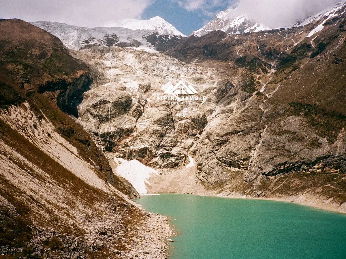
Lakes and High-Altitude Landmarks
- Birendra Lake (~3,691 m) near Samagaon, named after King Birendra
- Ponkar Lake (~4,100 m) near Bhimthang
- Multiple moraine lakes around Larkya La
These locations are remarkably quiet. Aircraft noise is rare. Infrastructure is minimal. Silence is often broken only by wind or distant avalanches.
Food, Language, and Daily Life
Diet adapts to altitude and transport limitations.
- Lower elevations: rice, lentils, vegetables, fruit
- Higher elevations: potatoes, barley, yak dairy, noodles, soups
Tea houses function as social centers. Travelers share dining rooms with guides, porters, and families who often live on-site.
Nepali acts as a common language, while Tibetan dialects dominate in upper settlements.
Safety, Medical Access, and Logistics
Despite remoteness, the route is structured.
- Health posts operate in villages including Samagaon
- Satellite communication is widely used by guides
- Helicopter evacuation is possible when weather allows
- Acclimatization days reduce altitude risk
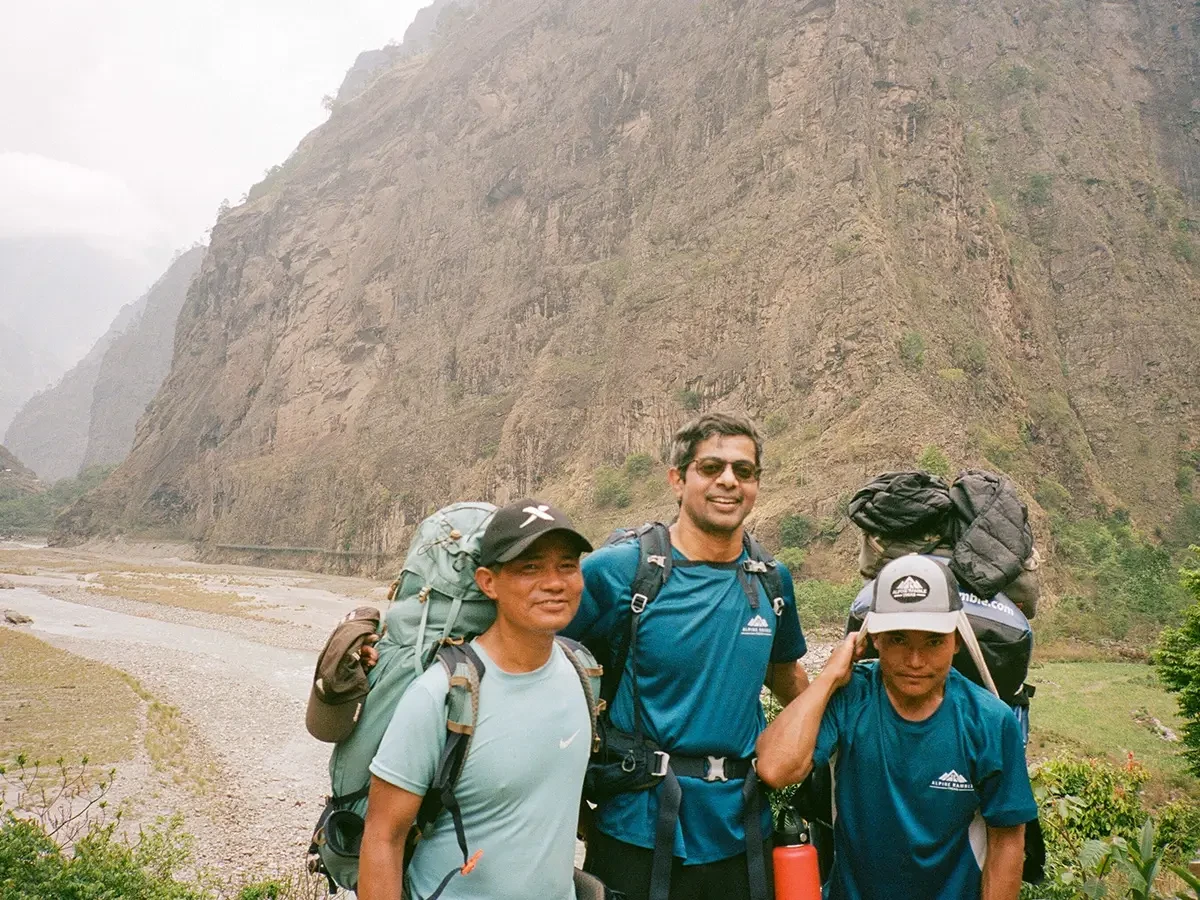
Licensed guides monitor symptoms, pace, hydration, and route conditions. Restricted-area regulations requiring guides contribute to high overall completion rates.
Why a Local Guide Company Matters Here
This landscape cannot be fully understood through maps alone.
Guides from the region possess generational knowledge: alternate routes during landslides, subtle weather indicators, culturally appropriate behavior in villages, and personal relationships that open doors not available to outsiders.
Interactions shift from transactional tourism to hosted travel. Conversations become easier. Cultural misunderstandings decrease. Safety margins increase.
You are not simply being shown a destination. You are being accompanied through someone’s homeland.
How This Trek Compares Globally
Compared with major Western long-distance trails:
- Tour du Mont Blanc — extensive infrastructure, heavy seasonal crowds
- Alta Via routes — dramatic but culturally European
- Rocky Mountain trails — wilderness without permanent villages
The Manaslu Circuit combines extreme mountain terrain with continuous human habitation shaped by centuries of adaptation, creating a hybrid experience of expedition travel and living anthropology.
Who This Trek Is Truly For
- Travelers seeking authenticity over convenience
- Experienced hikers wanting a quieter Himalayan route
- Culturally curious explorers
- Physically fit newcomers to high altitude with preparation
- Photographers, naturalists, researchers
- Solo travelers preferring guided safety
What Most Travelers Remember Most
Not a single viewpoint.
Not a single summit.
But the feeling of moving through a self-contained mountain world that exists independently of tourism.
- The rhythm of walking
- The sound of the river at night
- Warm dining rooms after cold days
- Stars unfiltered by urban light
- The quiet realization that this landscape will continue unchanged whether trekkers arrive or not
The Manaslu Circuit Trek is a high-altitude route circling Mount Manaslu (8,163 m) through remote Himalayan villages, diverse ecological zones, and the Larkya La Pass (5,106 m), offering one of Nepal’s most culturally intact and least crowded trekking experiences.
What is the distance of the Manaslu Circuit Trek?
The Manasu Circuit trail is roughly around 180 km, or 110 miles. From flat trails to rugged, stoney terrain, the Manaslu route is a voyage of diverse landscapes and cultures.
What is the maximum altitude of the Manaslu Circuit Trek?
The highest point of the trek is Larkya La Pass, at 5106 meters. Trekking through the rugged terrain and changing landscapes, you will reach the Larkya La Pass.
The top is draped in enchanting prayer flags, and you will feel the tranquility at the highest point of the trek.
Is the Manaslu Circuit Trek difficult?
On a rating scale, the Manaslu Trail is considered a moderate trek, but of course it depends on your preparation level, physical fitness, and mental endurance, as well as your ability to adapt and cope with high altitude and cold weather conditions.
But, of course, our guides and porters will be there to ensure the best and safest trekking experience.
What is the best time/ season for the Manaslu Circuit Trek?
Trekking in Nepal is best done in the spring, when it is warmer than other times, or in the autumn, when it is cooler but still lovely. However, trekking in the winter is one of the best trekking experiences. You will, of course, have to brave the hard, cold weather and snow, but the views of the mountains will be clearer with no clouds in the way.
We also do not recommend the monsoon season because many areas are prone to landslides, which can block roads, causing transportation issues and overall safety. However, due to the changeable climatic patterns, it is best to obtain meteorological information from a reliable source before embarking on your walk.
Is the Manaslu Circuit Trek safe?
Manaslu Circuit is one of Nepal's most rural and underexplored areas. And, being a restricted area where solo hiking is not permitted due to safety reasons,. However, employing a professional guide and porter is the best way to assure your safety while trekking in the Manaslu region.
The guides, with their extensive experience, are superb at navigating the terrain and will put your safety above all else. To ensure your safety, we recommend that you trust your guide's decisions and follow his recommendations. Communication with your guide is critical for ensuring a safe and enjoyable tour.
What should I pack for the Manaslu Circuit Trek?
Proper equipment and gear are required for the Manaslu Circuit Trek. Without sufficient advice, it is easy to either overpack or underpack. As a result, we will offer you a list of the necessary equipment and apparel for this excursion!
Equipment:
- Duffel bag
- Backpack
- Rain cover
- Water bottles and Thermos
- Trekking poles
- Trekking shoes
- Winter sleeping bag
Clothing:
- Innerwear
- Base layers
- House clothes
- Trekking shirts
- Trekking trousers
- Fleece jacket
- Waterproof winter jacket
- Windbreaker
- Down jackets and down pants
- Buff masks
- and inner gloves
- Waterproof gloves or mittens
- Warm hat
- Sunhat or sports cap
- Spare clothings
These are the standard trekking clothing and equipment that are required for the Manaslu Circuit Trek. Of course, our team will be there to check and offer you advice and recommendations before embarking on the trek to avoid experiencing bad situations.
Do I need travel insurance?
Yes, travel insurance is mandatory for trekking in Nepal. Your travel insurance must cover medical and emergency repatriation, inclusive of helicopter rescue and evacuation expenses at high altitude, at least for individual trekking members.
Please kindly provide us with your insurance at the time of booking your trip or later, before your trip gets started. It is imperative that you get your travel insurance before entering Nepal. Your travel insurance for a trek must cover certain elevations corresponding to your trekking destination’s highest point.
What is the procedure for getting a visa?
You can get an Arrival Visa at Tribhuvan International Airport in Kathmandu, Nepal, upon arrival. The visa fee for a three-month tourist visa is 40 USD; it's playable at the airport. Please note that your holding passport should be validated at least six months from the date of your arrival.
Meanwhile, travelers of Indian and Chinese nationalities are not required to pay this fee since the country has declared a free visa for these two countries!
How do I book the trek?
Alpine Ramble Treks (P) Ltd. is a government-authorized and registered trekking and adventure operator based in Nepal. The company's registered number is 178805/074/075.
We are also associated with various local and international tourism associations; therefore, any adventure-interested person is heartily welcomed to be booked and be part of our family. We treat you as family members while traveling with us. We are called the Mountain family, away from home.
To process a trip booking with us, you're required to deposit 20% of the full trip cost in advance to make sure all the reservations, such as hotels, guides, trekking permits, transportation, etc.
The remaining payment can be easily made to us on your arrival by credit card or in cash; cash would be much appreciated. At the same time, we would also like to request that you send all the required documents, such as a passport, copies of your travel insurance, and flight details, at the time of booking.
Last-minute booking
We accept any last-minute bookings from our valuable customers. To process the last-minute booking, please click here. Moreover, full payment is required for the last-minute booking. But last-minute bookings may not be acceptable for Bhutan and Tibet trips.
Arrival and Departure
Upon your arrival, our personnel will be there to pick you up at the airport. The person will be carrying a board with your name so you can spot them easily. A private car will transfer you to your hotel in Thamel. For departure, our personnel will be there to drop you off at your airport on your designated flight schedule in our private car.